Table of Contents
Style
With the style assistant you can adjust various options for every waypoint, route and track. Therefore start the assistant:
- you can also select several objects in the Xplorer, then the changes in the assistant will be adapted for all selected objects
- for a loaded map with style in the project manager
- or with style from the map-Popup menue
After that the style - window opens with several registers for the adaption of different style characteristics.
Generally
Labelling
Through the Label tab (above right) you can specify several parameters which influence the style of the waypoint labelling like font, size and color, text background color and placing and alignment of the text. You can also select which kind of information should be plotted as waypoint label. These are the options: Name, Coordinates, Date, Description and Altitude.
Symbol
On the Symbol tab (above left) you can specify wich symbols should be used and in which color and size they should be plotted. You can also specify how a symbol should be projected in the 3D mode and if you want to apply a rotation or tranlation to the symbols.
Symbol Trackpoint
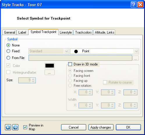
On the Symbol Trackpoint tab (above left) you can specify if trackpoints should be plotted and, if so, in which which symbol, colors and size. You can also specify how a symbol should be projected in the 3D mode and if you want to apply a rotation or tranlation to the symbols.
Line
On the Linestyle tab (above right)you specify the line type, color and line with (seperate for ourline and filling). You can also disable that tracklines are being plotted.
Track colours
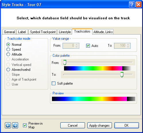
Select normal on the Trackcolors tab if you want the trackline to be plotted in the color which you specified in the Linestyle tab.
If you want the trackline to be color-coded according to Speed, Altitude, Acceleration, Vertical Speed, Slope or Age of the trackpoint, tickmark the corresponding option.
For further detail please refer to the chapter Color-Coded Tracks.
Height, Links
The last tab of the Track Style Window summarizes options related to altitude in the 3D mode and to links which can be attributed to the track.
Concerning altitude, you can assign the track to sealevel (down to zero), stick it to the ground surface (clamp to ground) or plot the track according to the measured altitude value of the GPS unit (Absolute). You can also define an offset which corresponds to the altitude above surface relief.
Under Links in map, you can link symbols or photos to trackpoints and define a size and an offset for their placement relative to the corresponding trackpoint.
![[Translate to English:] QuoVadis GPS](/fileadmin/_processed_/5/b/csm_QuoVadis-Logo_JTL_dadf090183.png)


