
Table of Contents
Planning a route
todo
We select Plan new route  button from the planning tolbar :
Now several things are happening at the same time:
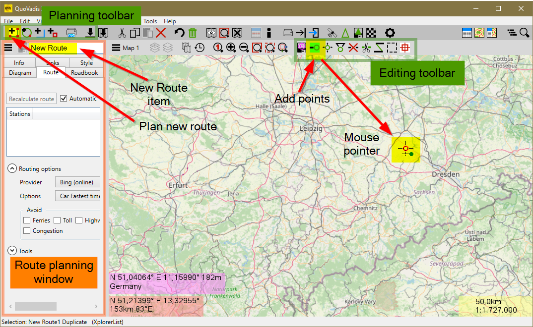
- A new, initially empty route with the name “New Route” is created in the database.
- The route planning window opens
- In the map, the function Append points
 is activated from the editing toolbox
 - The mouse pointer in the map changes to indicate the active function
We can start right now to put points on the map that form the stations of our route. We set the start to Windhoek and the second to Swakopmund, our destination. Result are two points 001 and 002 and a straight green line:

Now we are changing the routing options, because we don't want a beeline route today. But first you switch off attach points again, because we don't need the rubber band anymore.
QVX offers a wide range of routing options, offline and online. We select “Microsoft Maps” and immediately the route is recalculated and the result is displayed:


That's it, we can give the route another name, open the tools and get the altitude profile online and and and look at the profile on the XY page and the details on the roadbook page.


For the way back another route
- Close planning
First we create a duplicate of the route:
- Route Show in database

- Duplicate
- Drag duplicate into card
- Remove original from card
Now edit the route:
- Open info from duplicate
- Rename
- Tool Reversing * * Insert
 point** activate
 - Set a point at Boshua pass, another one in the Namib
