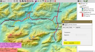
Elevationdata
- Slope inclination
- Hillshading
-Atlas shading.
Many other parameters can be set. Furthermore the data can be used for the offline creation of height profiles for routes and tracks. All options are described in the Wiki. To use this data, at least QVX 1.0.7.17 is necessary.
Page 1 of 1
Items 1 - 11 of 11

Alps Elevation Data 25m/1cm QVX
40,98 € *
Germany Elevation Data 25m/1cm QVX
40,98 € *

France Elevation Data 25m/1cm QVX
40,98 € *

Italy Elevation Data 25m/1cm QVX
40,98 € *

Switzerland Elevation Data 25m/1cm QVX
40,98 € *


Austria Elevation Data 25m/1cm QVX
40,98 € *

Alps DEM SRTM1 raster 30m
49,00 € *